Impacts from Washington floods flow downstream
Major flooding is sending debris downstream and causing unusual currents.

The ongoing wet weather and flooding has impacted thousands of Washington residents from complete loss of their homes to power outages and closed roads.
Gov. Ferguson called it "one of the most devastating" natural disasters in state history. Yet in other parts of the state, the impacts are minimal and in some places, including Seattle, it didn't rain as much.
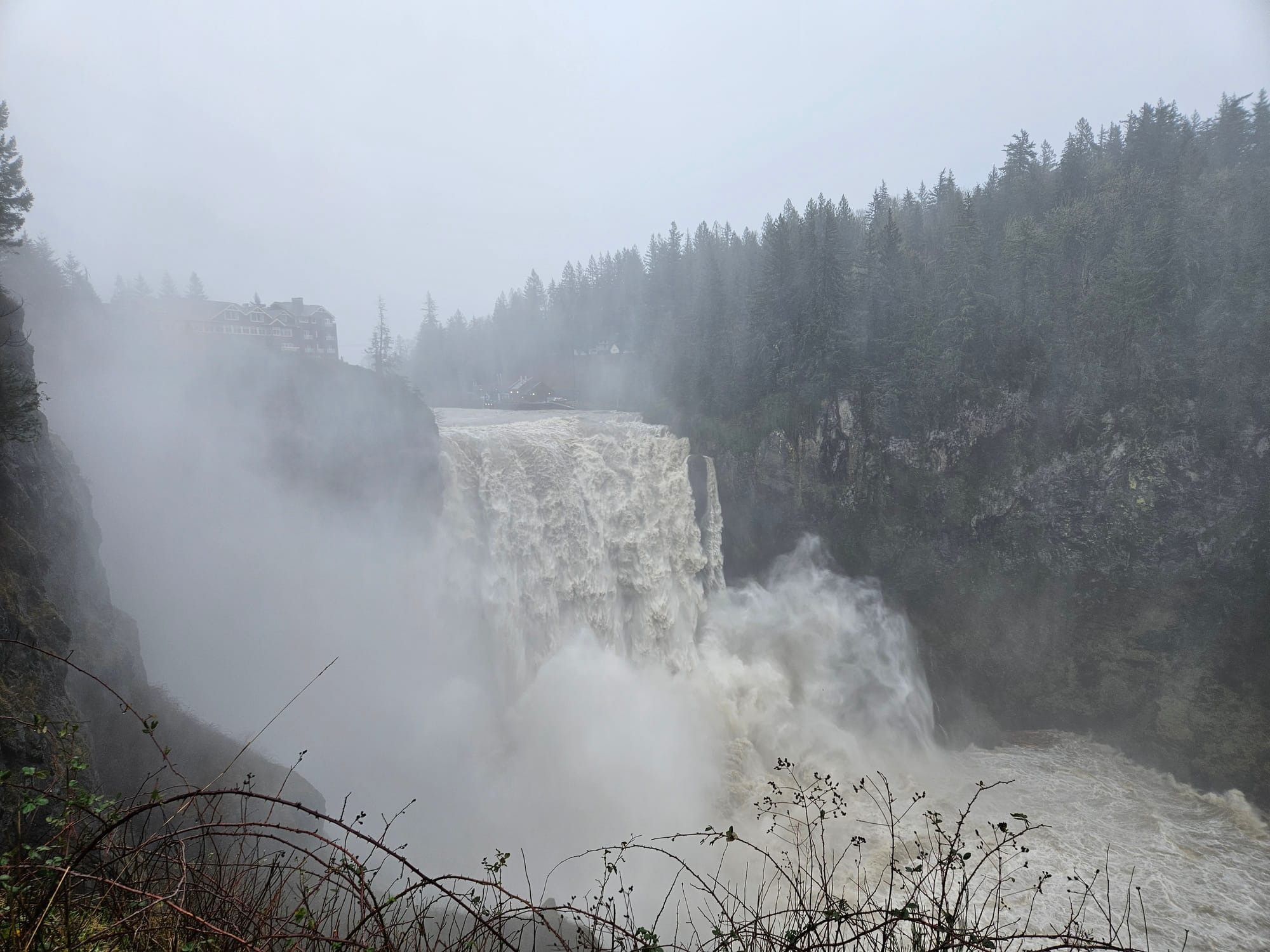
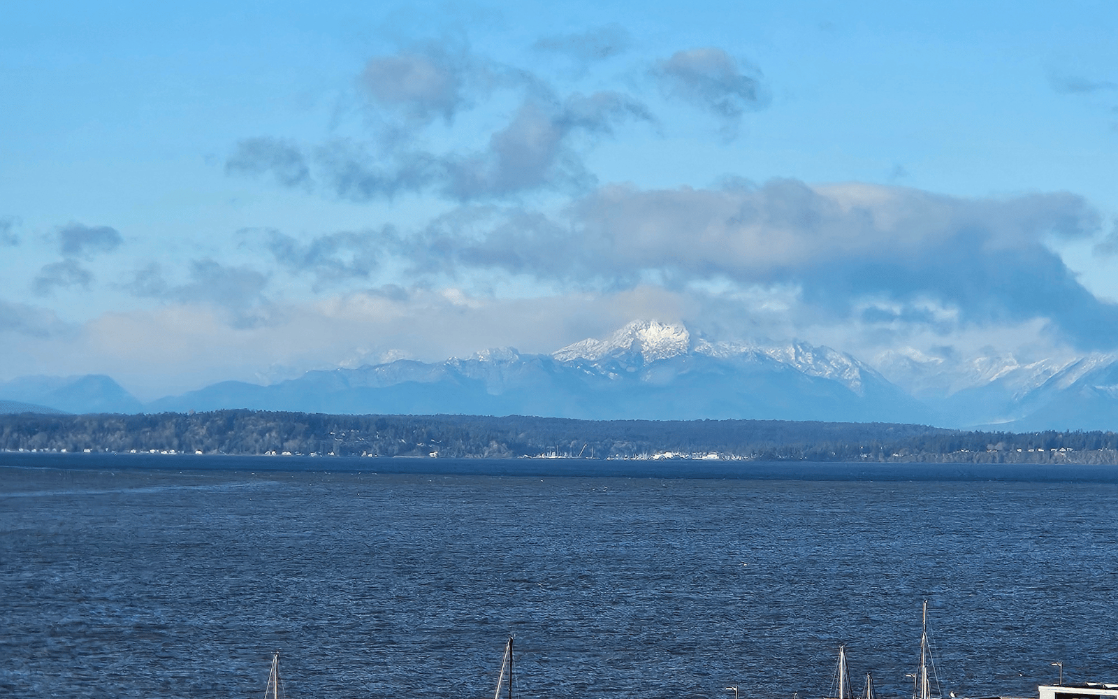
I witnessed firsthand the flooding Snoqualmie River and gushing falls. I also experienced sunny and calm days in downtown Seattle. Even while seeing photos and videos of the damage elsewhere, its disorienting to swing from a major weather event back to "business as usual."
However, including downstream, it won't be business as usual for a while.
Elliot Bay is brown instead of its varying hues of blue. Boaters are reporting unusual currents and debris. And wet weather continues in the forecast.
Water, water, water
It may seems obvious: all that water has to go somewhere. Puget Sound and the Salish Sea are the outlet for the region's complex natural river systems, made more complex by development and dams.
The Snoqualmie and Snohomish Rivers meet and enter Possession Sound near Everett. The Green-Duwamish River flows into Elliot Bay. The White and Puyallup Rivers join the Sound in Tacoma. The Skagit River's extensive floodplain leads to Skagit Bay, east of Whidbey Island. The Nooksack drains into Bellingham Bay.
All these rivers reached flood stage in the past two weeks, including some setting new records.
Downstream impacts
This is an incomplete list of how the flooding is now impacting larger waterways where commercial and recreational boaters operate:
Where river meets sound
On Dec. 16, looking west from downtown Seattle, Elliot Bay looked noticeably different. It looked brown.
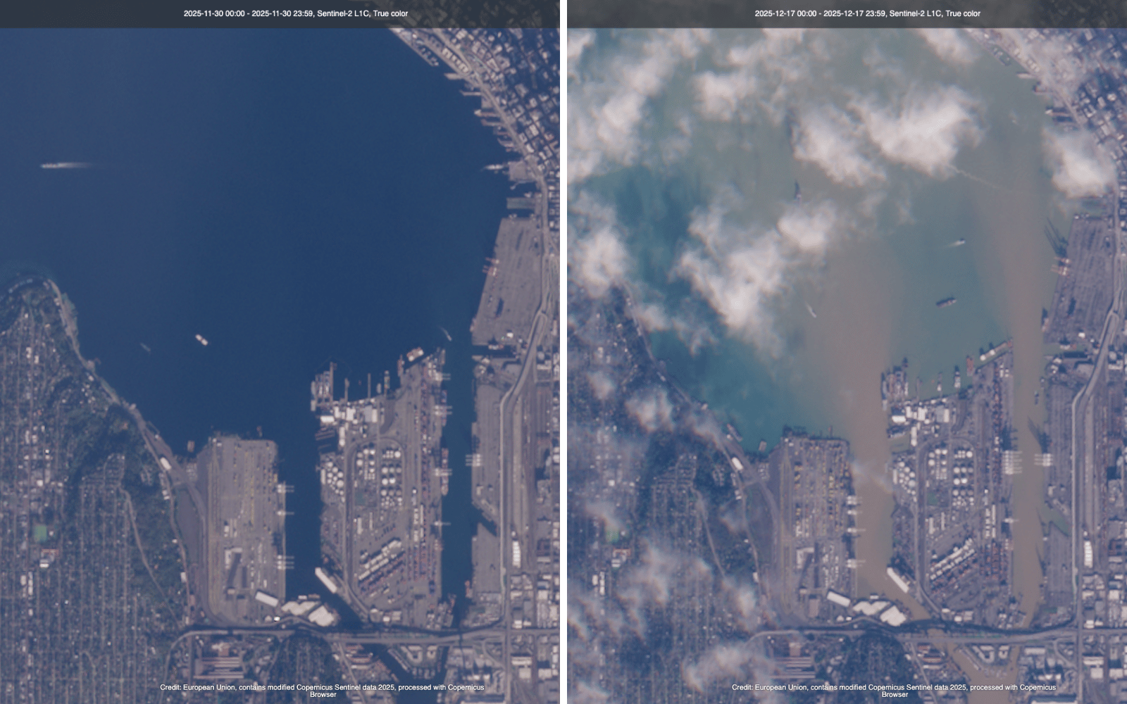
Sediment and heavy rainfall flowed into the busy harbor, a reminder of the catastrophic flooding elsewhere. Satellite images illustrate the dramatic change (more before/after satellite images on Reddit, thanks to user Cryptikfox for the inspiration).
Tides and currents also added to the effect, creating a clear divide between brown and blue water. Washington State Ferries used the conditions as a training opportunity. Though less noticeable on Dec. 17 after an overnight wind storm, the line remained visible from shore.
The Ballard (Hiram M. Chittenden) Locks
The current at the Locks is stronger than usual due to increased flows. On Dec. 12, a man died while kayaking near the Locks, and another kayaker was rescued. An observer told The Seattle Times that he witnessed the man being swept over the dam. An investigation is ongoing.
The U.S. Army Corps of Engineers, which operates the locks, recommends boaters remain aware of their surroundings, weather conditions and lock status. Following the storms and flooding, they also recommend "boaters slow down and be aware of flooding debris."
On Thursday, Dec. 17, the Large Locks closed for approximately 24 hours for emergency repairs. According to USACE, this closure was unrelated to the current conditions and due to an issue in the pump chamber. A temporary repair is in place. If it does not hold, the Large Locks may close again for a longer duration.
Boaters can check the USACE Lock Closures page or the USCG District 13 Mariners Notices for status updates.
Ghost ship
A now-viral WSF social media video shows a 100-foot fishing vessel drifting between an arriving ferry and the Mukilteo terminal in the dark. With no lights and no crew, the "ghost ship" presented an eerie hazard that WSF crew safely navigated.
The vessel, identified as F/V Mary B, was one of three boats that broke free of their moorings near Everett, according to The Whidbey News-Times. A tow boat later retrieved the Mary B.
Debris
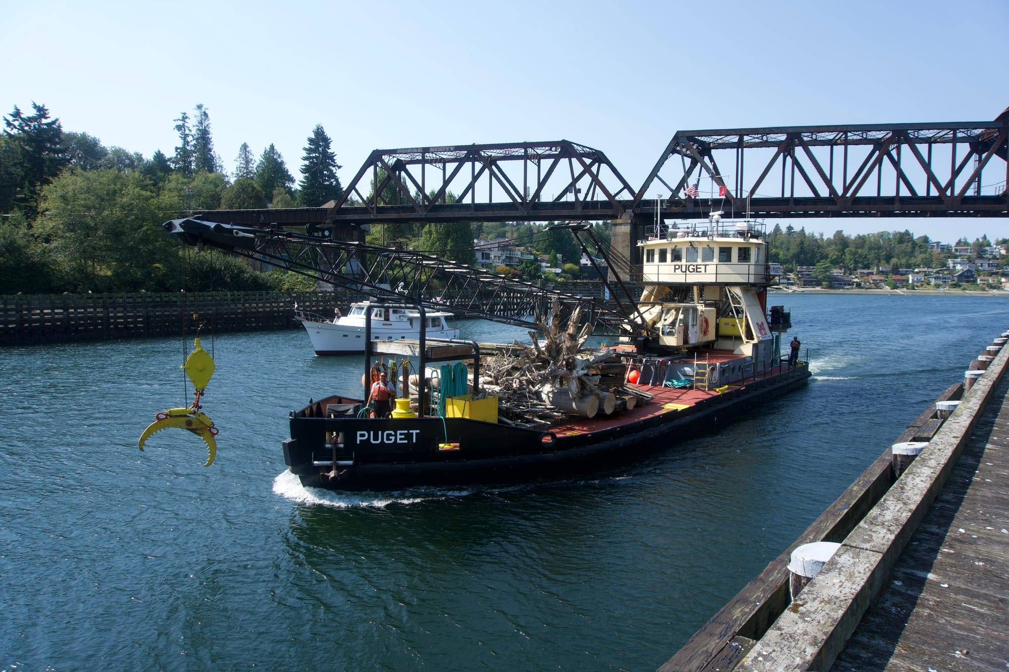
The USACE also runs a Debris Recovery program on Puget Sound and has a dedicated debris vessel M/V Puget, but the crane-equipped ship is currently in the shipyard for maintenance.
USACE Public Affairs Specialist Kimberly Lopes said in an email that while the immediate priority is supporting ongoing flood-fighting operations, they are acquiring additional resources and preparing to address debris. In addition to its own dams, the Corps took over management of several utility-owned dams as part of the flood emergency response.
Lopes said while "the woody debris presents a significant hazard to navigation," there have been limited impacts to commercial vessel traffic so far. However, boaters should still be extremely cautious and can report any navigation hazards online.
King County Water Taxi lookouts used infrared goggles to spot debris and logs along their route, according to KUOW.
Ports around the region are also on the alert for debris. Port of Everett Marina Manager Kate Anderson told Future Tides in an email that while there is more debris in the water than normal, that's typical after every big storm. Their priority is to clear some of the logs and debris so they don't get stuck under docks.
Salmon runs and habitat
Long term, the Washington Department of Fish and Wildlife is anticipating reduced salmon returns as a result of the flooding. Fish eggs, including from spawning salmon, may be washed away or buried.
Other contributing factors are damaged habitat and water polluted by a wide variety of substances that entered the water system as a result of flooding.
The impacts on local marine ecosystems, such as Bellingham Bay, are not yet clear but water quality is a concern.
Water quality
Whatcom County, one of the worst hit by heavy rain and river flooding, is advising residents avoid parks that flooded along the Nooksack River as floodwaters contain "large amounts of human and animal sewage, and possibly chemicals."
County health officials are advising that people avoid direct contact with flood waters. Downstream, where contaminated flood water can affect marine waters, the recommendation is to avoid contact with surface water for at least a week.
Poor water quality impacts shellfish operators too. The Lummi Bay and Portage Bay growing areas both closed for a period in December, according to the Whatcom County Health Department.
USCG safety guidance
Safety is always a concern on the water and all agencies contacted by Future Tides emphasized extra vigilance following this series of atmospheric rivers.
Hazardous conditions include strong currents and floating debris, as mentioned above, but also submerged objects that may be difficult to see.
The USCG recommends that boaters:
- Stay Informed: Monitor weather broadcasts and heed all marine warnings. Check the local NWS forecast and USCG Local Notice to Mariners.
- Be Vigilant: Watch for floating debris, submerged logs, and other navigational hazards. If you see an unmanned and adrift vessel, contact the Coast Guard.
- Reduce Speed: Operate at a safe speed to allow for quick reaction to unforeseen dangers.
- Wear a Life Jacket: Ensure all persons on board are wearing a U.S. Coast Guard-approved life jacket.
- Communicate: Carry a reliable means of communication, such as a VHF-FM marine radio.
Upstream from Puget Sound, the USCG has assisted with several flood-related rescues. In addition to the Notices for Local Mariners, they post regular updates on the Coast Guard Sector Puget Sound Facebook page.